


The current monitoring shows no signs of any imminent large landslides that would generate hazardous tsunami run-up affecting inhabited areas.
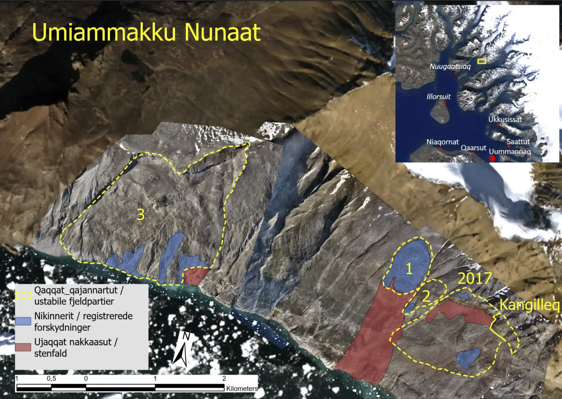
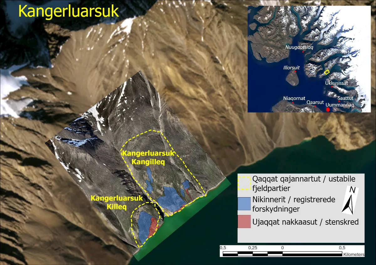
Spontaneous small-scale slides and rockfalls may occur on the rock slopes marked in red in Figures 1 and 2. Presence near these areas – whether on land or on water – is advised against.
Summary of monitoring data for the past two months
Recorded rockfalls and movements on the monitored rock slopes are shown as coloured areas in Figures 1 and 2 below. Blue areas indicate persistent sliding movement, while red areas mark locations with repeated rockfalls within the past two months.
Umiammakku Nunaat:
Monitoring data continue to show activity in the monitored rock sections at Umiammakku Nunaat in the form of steady displacements and rockfall activity.
Over the past two months, frequent rockfalls and minor slides have been observed, especially in the lower parts of the unstable slope “Umiammakku Nunaat 1”. These conditions have been observed in previous summers. An increase in the frequency of rockfalls immediately east of the 2017 slide was observed during late August and is being closely monitored. However, there are no definitive signs of the development of new, larger landslide bodies.
Kangerluarsuk:
The GPS stations at “Kangerluarsuk Kangilleq” show a slight acceleration in movements recorded in recent months, consistent with observations from previous years during the transition from spring to summer.
In the coastal part of the slope at “Kangerluarsuk Killeq”, rapid, steady displacements and frequent rockfalls continue to be recorded (see Figure 2). It cannot be ruled out that a coherent package could slide into the fjord from this area. Such an event is not assessed to be large enough to pose a risk to inhabited areas; however, it may cause local wave run-up in the Kangerluarsuk area.
The next situation assessment will be published on Wednesday, 1 October 2025. In the event of critical changes in the monitored areas, a notice will be published earlier.
A brief note on this year’s field activities
This summer, the Landslide Group carried out 18 days of intensive fieldwork in the Uummannaq area and along the coastal slopes by the Vaigat Strait on Qeqertarsuaq and Nuussuaq. In addition to revisiting monitored areas, the work included a regional screening of other areas. The field campaign thus covered, from north to south, more than 270 km of the west coast and encompassed an area of approximately 40,000 km².
The Landslide Group’s activities focused on strengthening the monitoring of unstable coastal mountain-slopes, and the work carried out consisted of:
- Multiple drone surveys covering a total area of 60 km²
- 30 ambient seismic measurements
- Installation of 6 new GNSS stations for online monitoring
- Maintenance of 2 existing monitoring systems
- Reconnaissance and inspections of several selected unstable slopes
Despite challenging weather conditions, the campaign was a success thanks to the dedication and collaboration of multiple professional partners.
Many thanks to: Gabriel Chevalier, Raphael Mayoraz, Air Greenland, the staff at Uummannaq Heliport, Hochschule für Life Science FHNW, Spektrum Geophysik, Geoprevent, Geotest, Avani, Angalasoq, Gamma Remote Sensing, Uummannaq Seasafari, as well as the many local supporters in the Uummannaq area.
