



The monitoring systems consist of several sensors that were installed in and around the unstable slopes. Other measurements are carried out during field visits.
The various instruments and measurement methods are presented below.
Collaborative partners: Glaciorisk, Geoprevent, GEUS
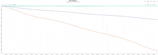
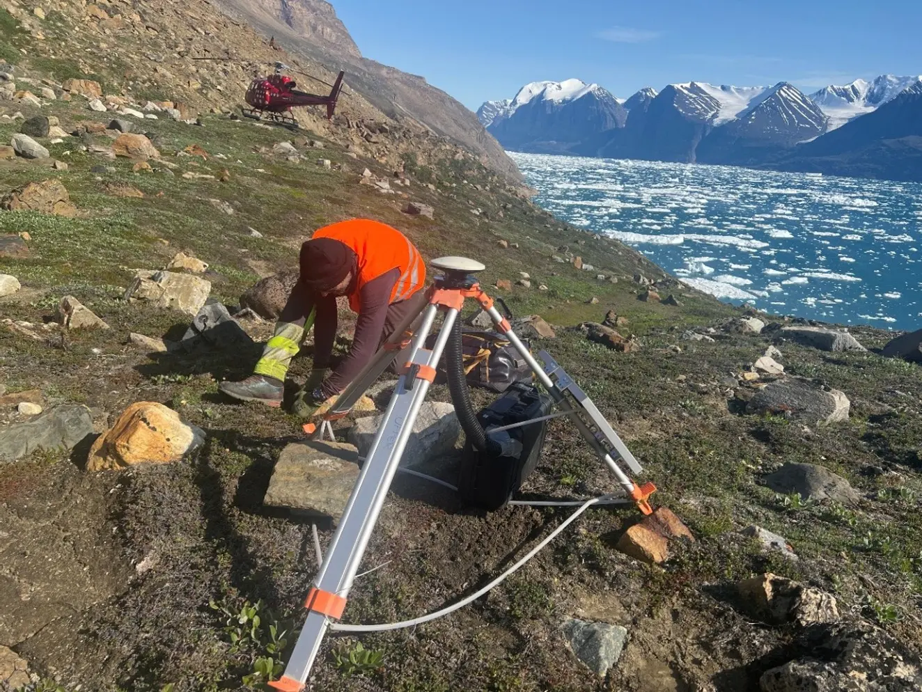
GNSS stations are GPS devices that measure continuous surface movements. A local reference station is set up on stable ground, while the other stations are set up on the unstable slope to measure movements.
The advantage of this measurement is that it is very precise and operates independently of weather and lighting conditions. On the other hand, it is only a point measurement, and the velocity may vary across the unstable slope. Some of the installed stations record GPS signals for 10 minutes once every hour throughout the year, after which the movements are calculated. Other stations outside mobile coverage operate offline, and their data must be collected and analysed manually each year.
Necessary cookies are absolutely essential for the website to function properly. This category only includes cookies that ensures basic functionalities and security features of the website. These cookies do not store any personal information.
| Cookie | Type | Duration | Description |
|---|---|---|---|
| __cfduid | 1 | 4 weeks | The cookie is set by CloudFare. The cookie is used to identify individual clients behind a shared IP address d apply security settings on a per-client basis. It doesnot correspond to any user ID in the web application and does not store any personally identifiable information. |
| cookielawinfo-checkbox-necessary | 0 | 11 months | This cookie is set by GDPR Cookie Consent plugin. The cookies is used to store the user consent for the cookies in the category "Necessary". |
| cookielawinfo-checkbox-non-necessary | 0 | 11 months | This cookie is set by GDPR Cookie Consent plugin. The cookies is used to store the user consent for the cookies in the category "Non Necessary". |
| PHPSESSID | 0 | This cookie is native to PHP applications. The cookie is used to store and identify a users' unique session ID for the purpose of managing user session on the website. The cookie is a session cookies and is deleted when all the browser windows are closed. | |
| viewed_cookie_policy | 0 | 11 months | The cookie is set by the GDPR Cookie Consent plugin and is used to store whether or not user has consented to the use of cookies. It does not store any personal data. |
Any cookies that may not be particularly necessary for the website to function and is used specifically to collect user personal data via analytics, ads, other embedded contents are termed as non-necessary cookies. It is mandatory to procure user consent prior to running these cookies on your website.
| Cookie | Type | Duration | Description |
|---|---|---|---|
| test_cookie | 0 | 11 months |
Advertisement cookies help us provide our visitors with relevant ads and marketing campaigns.
| Cookie | Type | Duration | Description |
|---|---|---|---|
| IDE | 1 | 2 years | Used by Google DoubleClick and stores information about how the user uses the website and any other advertisement before visiting the website. This is used to present users with ads that are relevant to them according to the user profile. |
| VISITOR_INFO1_LIVE | 1 | 5 months | This cookie is set by Youtube. Used to track the information of the embedded YouTube videos on a website. |
Analytics cookies help us understand how our visitors interact with the website. It helps us understand the number of visitors, where the visitors are coming from, and the pages they navigate. The cookies collect this data and are reported anonymously.
| Cookie | Type | Duration | Description |
|---|---|---|---|
| GPS | 0 | 30 minutes | This cookie is set by Youtube and registers a unique ID for tracking users based on their geographical location |
We use Performance cookies for internal purposes to help us to provide you with a better user experience. The cookies help us understand how our website is used by visitors. From this information we can improve the way the site works and presents content to you.
| Cookie | Type | Duration | Description |
|---|---|---|---|
| YSC | 1 | This cookies is set by Youtube and is used to track the views of embedded videos. |