


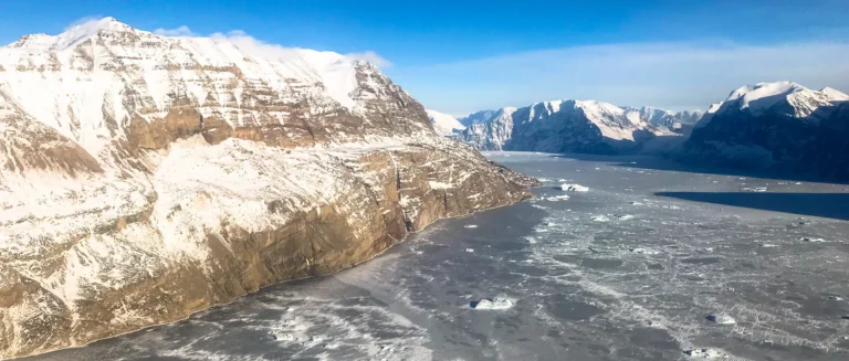
The monitoring shows no risk of major, imminent landslides or dangerous wave run-up in inhabited areas.
Spontaneous minor landslides may occur in the unstable mountain slopes marked in red in Figures 1 and 2. Staying near the areas marked in red is discouraged, both on land and at sea.
Summary of Monitoring Data for the Past Month
Umiammakku Nunaat:
Overvågningsdata viser fortsat aktivitet i de overvågede fjeldpartier ved Umiammakku Nunaat i form af stenfald og gradual displacements.
Monitoring data continues to show activity in the monitored mountain sections at Umiammakku Nunaat in the form of rockfalls and constant movements.
At Umiammakku Nunaat 1, 2, and 3, above the back wall of the 2017 landslide as well as 2017 kangilleq, frequent rockfalls and slides continue to be observed in the same manner as in previous months (see Figure 1).
As the number of days with temperatures above zero increases toward summer, thawing can be expected, along with increased activity in unstable mountain slopes. This is part of the seasonal variations in slope movement.
Kangerluarsuk:
Slow and sustained displacements have been recorded by GPS stations in “Kangerluarsuk Kangilleq”. In the coastal section of the slope at “Kangerluarsuk Killeq”, gradual displacements and frequent rockfalls continue to be observed (see Figure 2). It cannot be ruled out that a portion of mass may slide into the fjord from this area. This is inferred not to pose a danger to inhabited areas, though it may cause localized wave run-up in the vicinity of the slope.
As the number of days with temperatures above zero increases toward summer, thawing can be expected, along with increased activity in unstable mountain slopes. This is part of the seasonal variations in slope movement.
Registered rockfall events and displacements in the monitored slopes are shown as coloured areas on the maps in Figures 1 and 2 below. Blue areas indicate areas of persistent sliding movement, while red areas mark locations with repeated rockfall events within the past month.
The next situation assessment will be published on Wednesday, 7 May 2025. Should any critical changes occur in the monitored mountain slopes before then, a notice will be issued earlier.

